


CASE STUDY
Limestone Limpopo Project
Scope of Work
Overview
- Minrom supported an existing lime mining operation within the Limpopo Province of South Africa by investigating the lime resource base, developing geological models and describing the mineralisation potential within the Mining Rights Area.
- Initial models highlighting mineralisation potential were generated from historical diamond and RC drilling data. A follow-up pitting campaign was executed by Minrom and models were revised to establish a reliable Life of Mine (LOM) estimate based on observed grades and extent of mineralised zones. Various optimisations were performed.
Commodity
Industrial (lime)
Country
South Africa
Project Type
Mining & Exploration

Mining and exploration projects targeting industrial minerals are often overlooked in global and local markets as saleable products fetch lower prices and have a lower contribution to nations’ GDP. However, the steps taken to generate and sustain a successful mining operation is much the same as those taken for precious metals like gold. In certain cases, it is more important because the profit margins will require stricter control.
Minrom has been actively involved in developing and executing an exploration strategy at a prominent lime mining operation in the Limpopo Province of South Africa. The project produces both industrial- and agricultural-grade lime products, as lime is one of the most important industrial commodities.
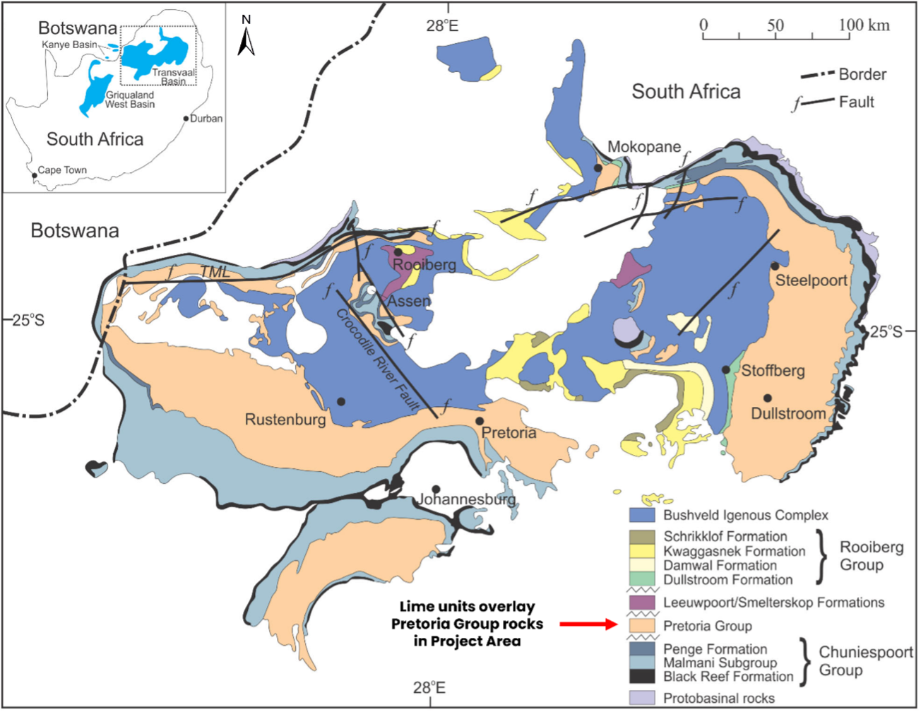
In the project area, the geology is dominated by Pretoria Group rocks, which form part of the Transvaal Supergroup. Tertiary to Quaternary-aged sediments unconformably overlay Pretoria Group rocks, with these younger sediments containing CaCO3 mineralisation, which is hosted in thick (3-12 m) calcrete beds. These calcrete beds contain calcium carbonate grades of 60 – 90% CaCO3. The higher the grade or percentage of CaCO3, the greater the purity of the lime aggregate produced.
Regional Geology
Minrom performed a mineralisation quantification based on historical diamond and RC drilling data for the Mining Rights area. This included the development of a preliminary 3D geological model for the deposit, which highlighted mineralisation potential based on CaCO3 grades and the measured thickness of calcrete units.
After developing the initial geological model, Minrom performed a follow-up pitting programme within the mine area to investigate the profiles of the subsurface geology and update the previous mineralisation estimate. The overarching aims for this phase of work were to define the extent of the mineralised areas better and to assess CaCO3 grades (and grade continuity) to establish a reliable Life of Mine (LOM). The pitting campaign was successful, and the resulting models generated considered different mineable zones, varying depths, and had several ranges of cut-off grades. These models have helped mitigate risk for our client and helped optimise mining operations.
Figure 1
Simplified geological map of the Transvaal Basin (modified from Eriksson et al., 1995).
Regional Geology
Figure 1
Simplified geological map of the Transvaal Basin (modified from Eriksson et al., 1995).
Minrom performed a mineralisation quantification based on historical diamond and RC drilling data for the Mining Rights area. This included the development of a preliminary 3D geological model for the deposit, which highlighted mineralisation potential based on CaCO3 grades and the measured thickness of calcrete units.
After developing the initial geological model, Minrom performed a follow-up pitting programme within the mine area to investigate the profiles of the subsurface geology and update the previous mineralisation estimate. The overarching aims for this phase of work were to define the extent of the mineralised areas better and to assess CaCO3 grades (and grade continuity) to establish a reliable Life of Mine (LOM). The pitting campaign was successful, and the resulting models generated considered different mineable zones, varying depths, and had several ranges of cut-off grades. These models have helped mitigate risk for our client and helped optimise mining operations.
Photographic Data
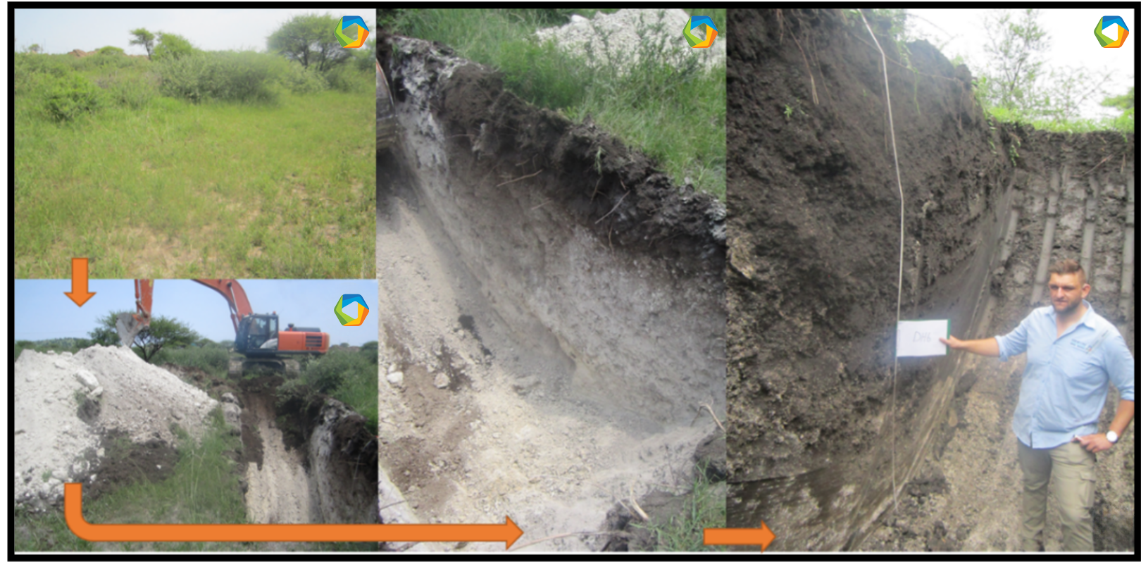
Figure 2
Logging excavated pits
Photographic Data